Loyalists in the Eastern Townships
United Empire Loyalists In Quebec's Eastern Townships
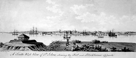
A South-West View of St. Johns, Quebec ca. 1784, by James Peachey (c) 2003
The American Revolution turned the Mohawk Valley and other Upper New York settlements into a bloody battlefields, torn by savage conflict between Rebel, Tory and Indian. Those loyal to the Crown suffered extreme persecution from their Patriot neighbours. Vast areas of farmlands were destroyed, making it impossible to provide food for the families. Following the loss of General Burgoyne in 1777, the number of Loyalist families seeking refuge in the colony of Quebec greatly increased.
For nearly two years, the continuous influx of destitute families coming to St. Johns on the Richelieu River and Montreal became an insurmountable problem. In 1779, Governor Haldimand asked Sir John Johnson to take charge of these families, but he was fully occupied with the First Battalion of the King’s Royal Regiment which he had just formed. Capt. Daniel McAlpin was chosen instead to take on this responsibility.
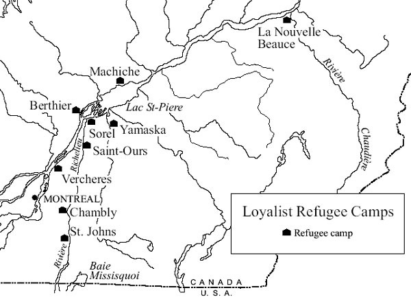
Governor Haldimand had tried to find accommodations for those refugee families and had employed the Loyalists, not listed with any corps (the unincorporated Loyaists), to build barracks to provide shelter in various places along the St. Lawrence and Richelieu Rivers. Refugee camps were located at Verchères, St. Ours, Yamaska, St. Johns, Chambly, Machiche (Yamachiche), Sorel, Berthier and Nouvelle Beauce. There were many Loyalists billeted with families in Pointe Claire, Lachine and Montreal. In addition, the Mohawk or “Christian Indians in Quebec” helped provide for the Six Nations of the Iroquois Confederacy who had been forced to flee their ancestral lands in upper New York as well. Following the orders of Governor Haldimand, Capt. McAlpin kept lists of all the families who were now entering the country: Provision List, dated 1 July 1779: “an effective list of all of the Loyalists in Canada receiving provisions from the King’s stores, that are not charged for the same: with an exact account of the number of the families, their age, sex and the quantity of provisions per day, with remarks opposite their respective names.” Following the death of McAlpin in 1780, Major John Nairne assumed the responsibility for the refugees.

Loyalist Refugee Camps, by Victor Dohar
Click here for a larger version
By the spring of 1781, the total number of people being provisioned was 1394; there were still 55 families at St. Johns, 66 families in Montreal, 6 families at St. Ours, 40 families and 2 orphans at Sorel, 93 families at Point Claire (mostly dependents of the Royal Regiment), at Yamaska there were 4 women with 18 children, at Berthier three and at Coteau du Lac there were 8 families all associated with the bateaux corps.
On 13 November 1781, the contract was signed for the purchase of the Seigneury of Sorel in the name of the King. This purchase was made for the settlement of Loyalists in the Province of Quebec, an idea that had been opposed because of the expanding French Canadian population and their future needs. But for the time, it was a compromise to fend off the demand for land in the Eastern Townships. Another area for settlement that was being considered had been partially surveyed twenty years before to accommodate the English settlers and soldiers after the conquest, and many, such as Governor Haldimand himself, had purchased land in the Gaspé.
After three years of negotiations, the Treaty of Paris was signed on 3 Sept. 1783 at Hôtel d’York on rue Jacob, Quartier Latin, Paris by David Harley for His Britannic Majesty and John Adams, Benjamin Franklin and John Jay, Ministers Plenipotentiary for the United States of America. The fighting was over and the guns silenced, but at the refugee camps, conditions had become more acute. Every camp was filled to overflowing and decisions had to be made before the spring of 1784.
In February 1784, the Quebec Gazette announced two settlements opening up in Gaspé. The refugee Loyalists who had been in camps for years were clambering to settle on lands promised to them by the government. Orders had gone out in 1783 to start the survey of lands west of Montreal, along the St. Lawrence River as well as along the Ottawa River. There were to be settlements at Cataraqui (Kingston) and around the Bay of Quinte, west of Kingston. In the spring of 1784, a notice appeared in the Quebec Gazette instructing all Loyalists to assemble at Quebec, Sorel and Lachine for departure to the surveyed settlements at Oswegache (Prescott) and Cataraqui.
Another notice which appeared in the Quebec Gazette on January 1, 1784 was of interest to those families who wished to stay in the area which some of them had come to think of as home, the eastern part of the large Province of Quebec, (the Province of Quebec was not divided into Upper and Lower Canada until 1791). This notice read as follows: “Colonel Henry Caldwell wishes to announce that he possesses land sufficient for settlement of several families which he is willing to let out forever on the most reasonable terms”…These lands, he stated were situated in a seigneury called Caldwell’s Manor which he had purchase from M. Foucault. Also, he was prepared to build grist and saw mills.
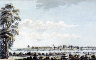
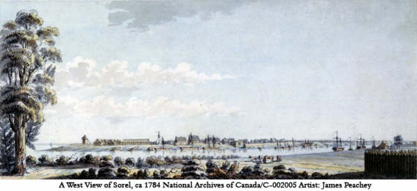
A West View of Sorel, Quebec ca. 1784, by James Peachey
Click here for a larger version
By the spring of 1784, several thousand people had made up their minds as to where their future homes would be located. Many took the opportunity to “go west”. Then there were those who preferred to live near the Atlantic Ocean. On 9 June 1784, 404 people left on the boats headed down the St. Lawrence to the Gaspé Coast.
At that time, there was a sizeable settlement already underway at Missisquoi Bay, much against Government sanction. The Crown Lands that stretched along the 45th parallel had been observed by the soldiers stationed near Lake Champlain or in Fort St. Johns
This region had not been settled and was known only to a few nomadic Indian tribes. Governor Haldimand had refused to consider the surveying of these lands.
These refugees who did not wish to settle in Gaspé or the new western townships refused to leave when they were ordered to do so. Earlier many of them had thought that they would be able to return to their homes in the new United States, but then realized that their farms and possessions had been confiscated by the rebels. These Loyalists, who had served with courage and honour during the War, were lead to believe that they could remain in the area which they had chosen, around Missisquoi Bay, and purchase the land from an old Indian deed. This plan fell through, but they continued to submit petitions to the government, asking them to survey the Crown Lands and deed the land to them as Loyalists. The soldiers, most of them stationed at Fort St. Johns, had started to build houses at Missisquoi Bay, believing that the government would soon open of the Crown Lands. The government of Haldimand sent soldiers to evict them and their families but they still refused to leave and kept sending petitions to the Government. . Others found that they could rent land from the two English seigneuries belonging to Colonel Christie and Caldwell on the other side of the Bay. Hundreds of petitions were sent during the next ten years. There are 381 Loyalist signatures on one of these requests. In the petitions, they asked that the land be granted in free and common soccage, instead of under the seigneurial system that had remained as a concession to the French in the 1774 Quebec Act.
In February 1787, a petition addressed to the The Honourable Guy Lord Dorchester states that: “the settlers of Sorel are not able to support their families on the small lots which have been granted to them I.e. 80 acres in or near the Village of Sorel, and they wish to take the balance of their land 120 acres, in the area between Missisquoi Bay and Pike River or near the South Branch of the River Yamaska.”
It was not until the Constitutional Act of 1791 divided the Province of Quebec into Upper and Lower Canada that the policy changed. Governor Alured Clarke‘s proclamation of 1792, ordered the surveying of the Crown Lands into townships of ten miles square, (one seventh would remain in the crown and one seventh was reserved for the Protestant clergy) or nine by twelve miles if on navigable waters. As requested by the petitioners, the grants were made with free land tenure. The grantees must cultivate the land and sign an Oath of Allegiance to the King of England. Samuel Holland was appointed Chief Surveyor. Two of the surveyors were Jesse Pennoyer and J.D. Duberger who worked together and by the end of the year, with the help of others, there were twenty-eight townships outlined and partly surveyed. Since some of the Loyalists had already settled before the surveying began, some were allowed to stay and were able to receive the grants where they had built. Those having built at Missisquoi Bay much earlier were very fortunate as Thomas Dunn bought the Seigneury of St. Armand, where they had settled illegally and he offered to sell them lots on the disputed land. This land has never been considered one of the Eastern Townships but has prospered with many of the early Loyalists working and building here. These, as well as many others were granted land somewhere else and their names are on the newly laid out grants, only to be sold at a later date.

Map of the Eastern Townships settled by Loyalists, by Victor Dohar
By 1802, the fifty-five townships that had been surveyed along with the three seigneuries had a total population of 8,192 inhabitants. A few years later another 9,000 Americans had taken up land in the Eastern Townships.
The Eastern Townships were granted under a different system than those in the western townships. They were granted to a Leader, usually a Loyalist, and his thirty or so Associates. There were two exceptions to this plan as the Township of Sutton was granted to 170 Loyalists with Letters Patent and the Township of Potton, was granted, in part, to Henry Ruiter and his family and the other part to Captain L. McLean.
Life was hard for our early United Empire Loyalist pioneers. We owe them a debt of gratitude for their perseverance and fortitude.
Adapted from “Refugees of the Last Frontier” in The Loyalists of the Eastern Townships of Quebec, 1984, and “Loyalists settled near Missisquoi Bay in 1784,” Crossroads, 1992. Both articles were written by Jean Darrah McCaw UE, genealogist for Sir John Johnson Centennial Branch.